Start: 7:20 AM
Finish: 4:30 PM (Entered central timezone)
Saddle Time: 6:02
Ascent: 1,227feet
Descent: 1,241 feet
Miles: 78
Total Miles: 1,494
Highlight: Stopping at the Painted Canyon.
Lowlight: Not realizing I entered central timezone and wondering why this ride took so long.
Cyclemeter: Follow this link to see the data I’m collecting with the cyclemeter app. You can see gps information, speed, elevation, distance, cadence and heart rate. Better viewed on a computer where it’s easier to play around with the graphs.
Today was a great day of riding. Of course it was windy but out of the north-northwest so NOT a tailwind. Well except for the last 5 miles or so where the wind just had to show me who’s boss. Wind by far has the largest impact on how enjoyable the ride will be, much more so that scenery, climbing or road conditions. Great scenery can be completely ruined by incessant headwinds while boring scenery can pass innocuously as just putting on the miles. I probably mention wind too much but it is what rules my day.
Sleep wasn’t great last night, but not terrible either. It was in 80’s to the high 70’s until around midnight, didn’t cool down into the 60’s until the early morning. I was a little too hot in the tent for comfortable sleep. If I wasn’t in a jam packed RV park I would have left the rainfly off for better ventilation.

I cooked up my camp breakfast for the first time in a while: oatmeal with a chicken bouillon cube and Old Bay seasoning, topped with some granola. I’ve been carrying this stuff around in my bags now for a couple weeks, finally getting to eat it again. I think adding the granola really packs in the calories so it keeps me going for a while.

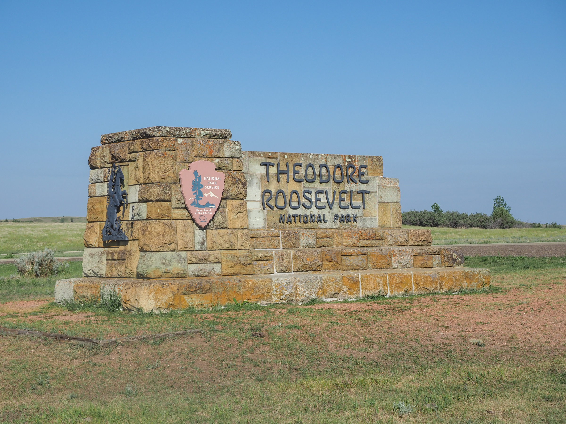
The route started with a bit of uphill out of the Medora area and on to Interstate 94. At about 10 miles I saw a sign for Painted Canyon, part of the Theodore Roosevelt National Park. At first I wasn’t going to stop since I was making good time with favorable winds but I had to remind myself why I’m out here, not just to cross the country by bike but to see things along the way. This is very much a downside of bike touring, you tend to dislike going off course knowing it’s just adding more time and miles to an already long day. I would have liked to ride around Makoshika State Park back in Glendive but I really didn’t want to add 6-8 miles at the end of the day when it was hot and I was tired or early the next morning when it would just make my day longer.
I’m glad I stopped because the visitors center and overlook was right off the highway. You can walk along the edge of the hillside and view the colorful canyon below. They had signs about staying away from the buffalo. While looking out on to one of the open areas below I could see two dark spots off in the distance that seemed big and slowly moving around. Must be buffalo. I still haven’t zoomed in on the pictures I took but I’m going with Buffalo. Too bulky to be something like a horse or donkey.


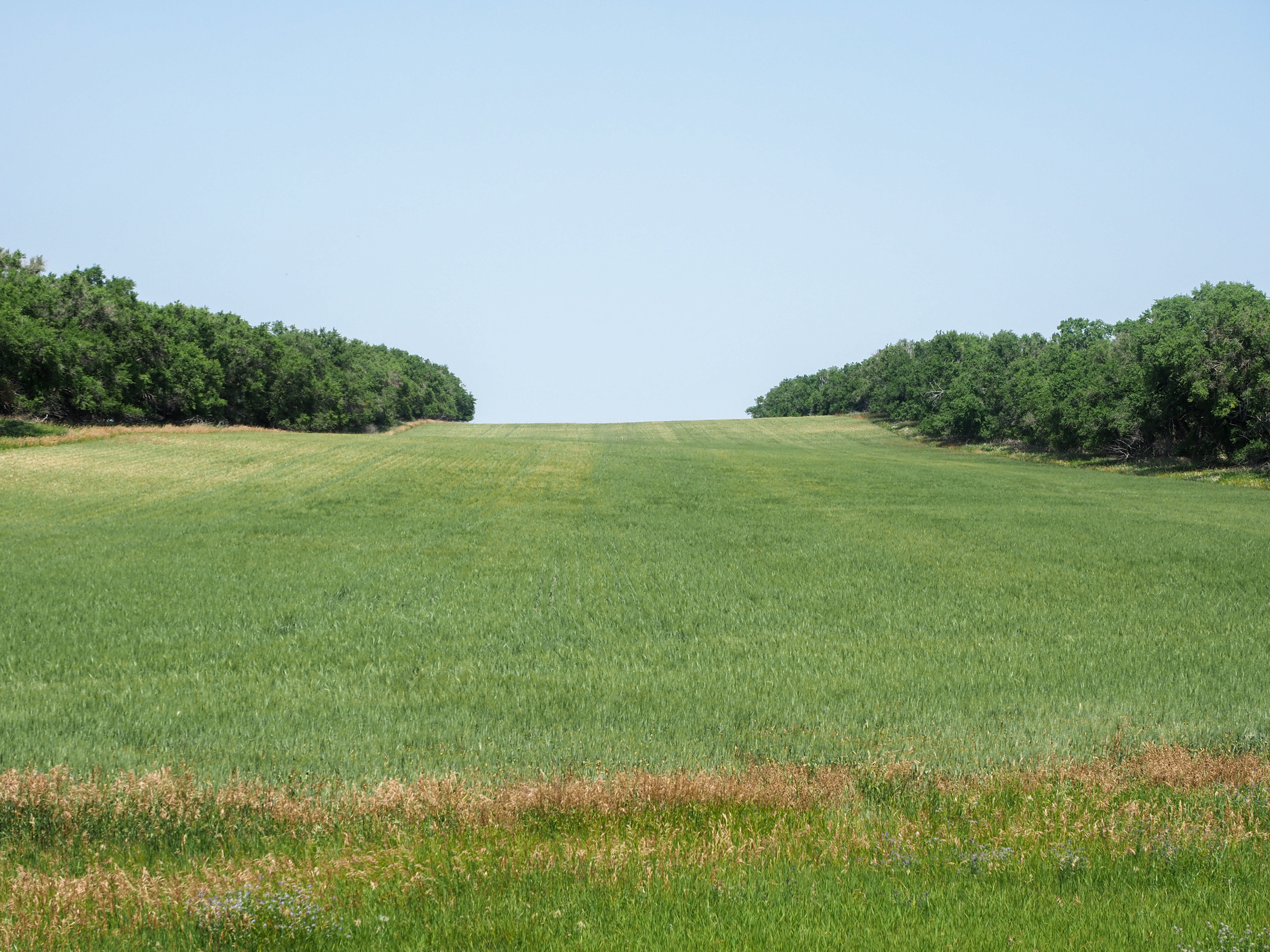
Soon after the overlook I made my way off the highway and on to Old Highway 10 now considered a scenic byway, a very nice, quiet and scenic road. I guess this is still prairie. The terrain is rolling hills with lots of grasses or wheat farms, along with the occasional corn field. There are a lot more trees here than in Montana. Some look like they occur naturally in low spots that probably collect water while others clearly have been planted in long rows, sometimes a few deep. Must be for windbreaks. I wondered if these date back to the post dust bowl era. I did a little bit of googling, one of Roosevelts programs was the Shelterbelt, the planting of 100 million trees from North Dakota down to the Texas panhandle so these very well could be those trees.

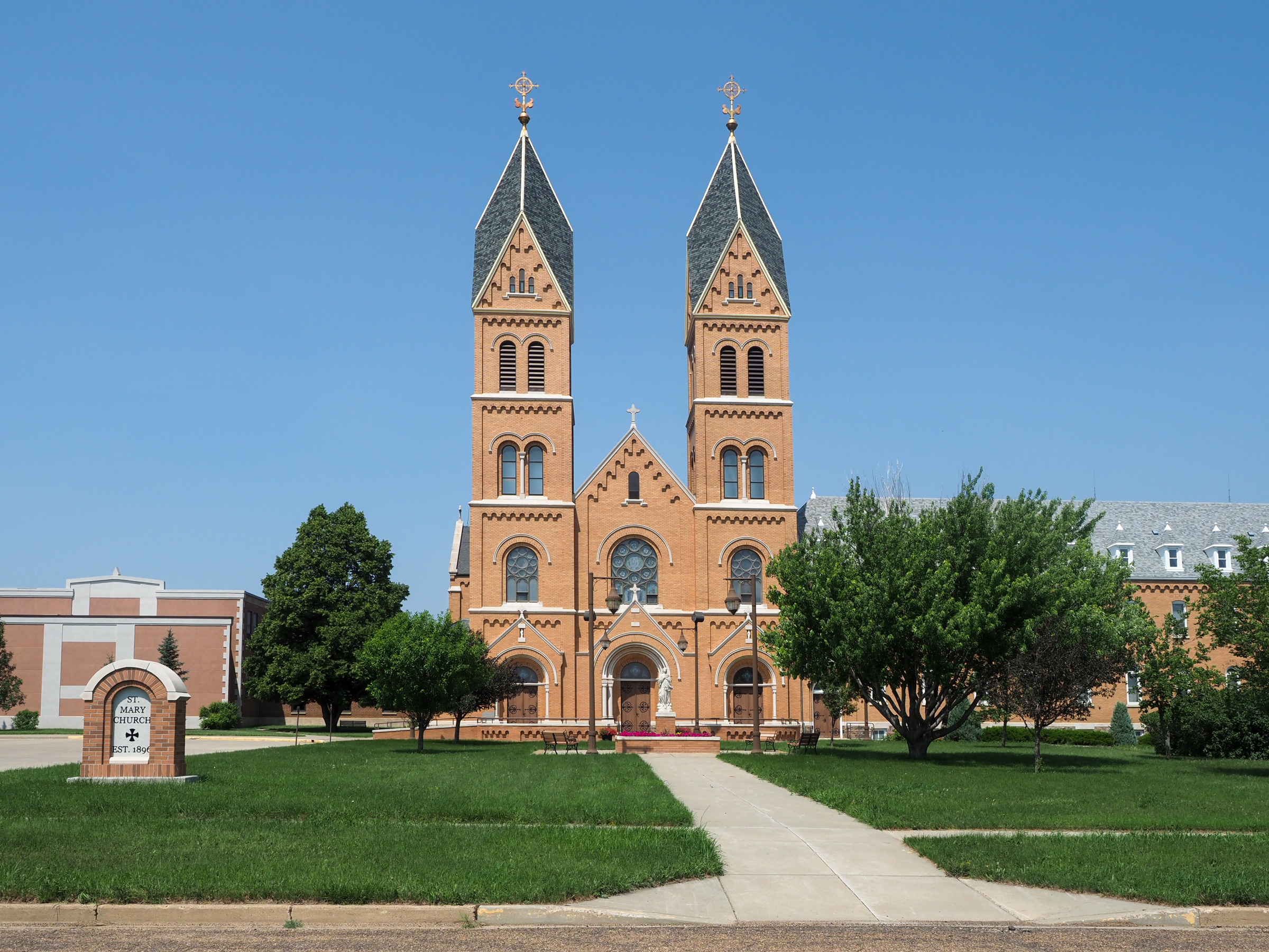
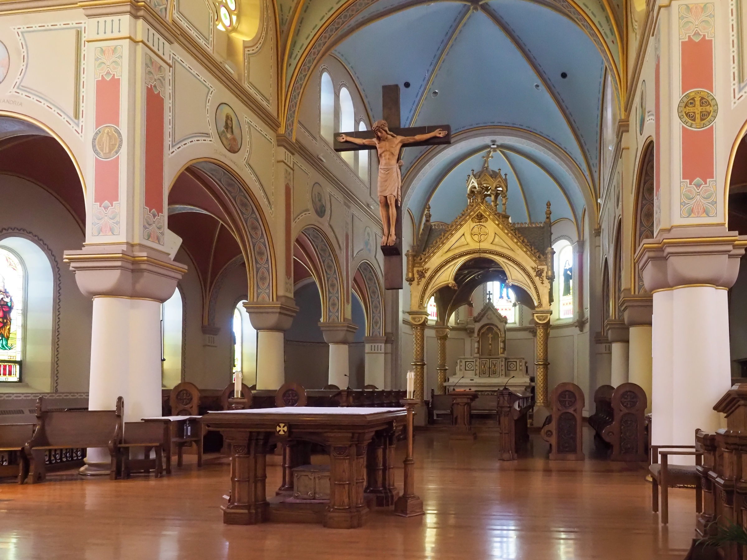
While approaching RIchardton, the town before my destination in Hebron I could see two spires sticking above the buildings, silos and trees so I wandered off route to investigate. It was Assumption Abbey, a Benedictine abbey of the American-Cassinese Congregation. Founded in 1893 the building was completed about a decade later. Very impressive looking from a distance. The inside was dark but the walls looked very bright like it was newly painted. I assume the ornate paintings are original.

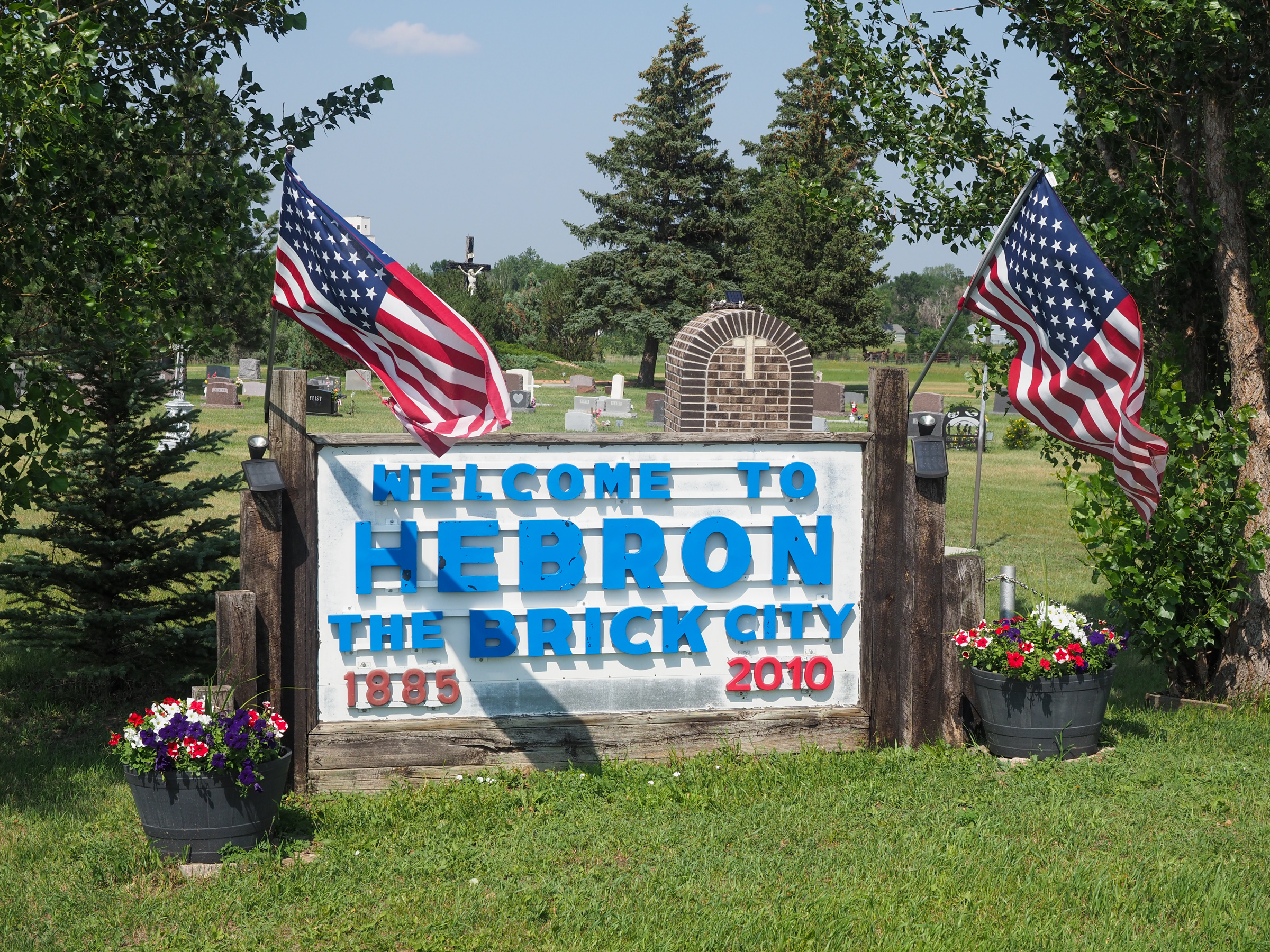
I made it to the tiny town of Hebron at 4:30 which at first I couldn’t figure out, I was making good time. Turns out I just barely crossed over into central timezone. I staying at the Brick City Motel for $85, a bit more than I wanted to spend but there was nothing else around, not even camping options. The place was really nice, must have been newly renovation because it’s clearly not a new building. The town has two bars and one restaurant, the Pizza Pantry, which is only open for 5pm-7:30pm. In addition to pizza they have two of the the other midwest favorites, burgers and chicken fried steak. I had a chicken fried steak, again. I’ve had a few over the past couple weeks. I so want a real restaurant. I considered the bars but their food options were even less, frozen pizza. I mentioned how everywhere here serves only burgers and steak, the other food is pizza, typically the frozen variety.

I need to start figuring out how I will travel through Minnesota. There’s a northern and southern option. Talking to west bounders I hear the souther option is shorter and also includes about 100 miles of rail trails. That may seal the deal for me. The other question is do I veer off the norther tier and head northeast then down the Michigan upper peninsula. I’ve also heard this is fantastic but adds more miles to the trip. One option that may make it a wash is riding the north shore of Lake Erie which would require the Canadian border to be open. I hear that may be a possibility soon. When I started this trip these decisions sounded so far off in the future now they are right around the corner.